Property Record
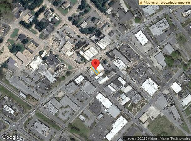
59 N Broad St, Winder, GA 30680
NEARBY LISTINGS FOR SALE OR LEASE
Property Detail
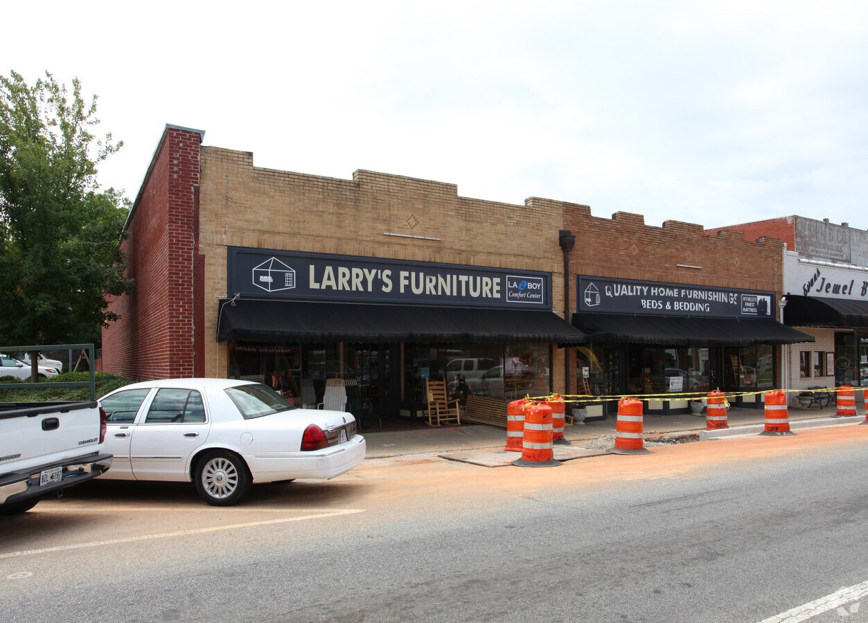
59 N Broad St
WN12-227
LARRY'S FURNITURE
Storesoffices
Barrow
X
Georgia
13013C0126D
0.10 AC
2024
S Barrow
2024
Atlanta
180204
Atlanta-Sandy Springs-Roswell, GA
3,134 SF
DEMOGRAPHICS near 59 N Broad St
1 Mile
3 Mile
5 Mile
2024 Total Population
6,869
27,610
48,515
2029 Population
8,012
32,355
56,885
Pop Growth 2024-2029
+ 16.64%
+ 17.19%
+ 17.25%
Average Age
38
38
37
2024 Total Households
2,631
9,832
16,805
HH Growth 2024-2029
+ 16.76%
+ 17.32%
+ 17.37%
Median Household Inc
$41,666
$58,983
$63,858
Avg Household Size
2.50
2.70
2.80
2024 Avg HH Vehicles
2.00
2.00
2.00
Median Home Value
$163,629
$195,276
$203,159
Median Year Built
1980
1994
1997
Nearby Places
- Restaurants
- Banks
- Shops
- Fitness
- Groceries
Nearby Properties
Address
Land Use
TOTAL SIZE
Lot Size
Zoning
Address
Land Use
TOTAL SIZE
Lot Size
Zoning
1,456 SF
1,732.80 AC
G
Address
Land Use
TOTAL SIZE
Lot Size
Zoning
165,737 SF
134.60 AC
G
Address
Land Use
TOTAL SIZE
Lot Size
Zoning
690,427 SF
156 AC
M-1
Address
Land Use
TOTAL SIZE
Lot Size
Zoning
105,850 SF
61 AC
G
Address
Land Use
TOTAL SIZE
Lot Size
Zoning
6,928 SF
358.90 AC
AC
Address
Land Use
TOTAL SIZE
Lot Size
Zoning
50,000 SF
29 AC
G
Address
Land Use
TOTAL SIZE
Lot Size
Zoning
89,684 SF
64.90 AC
B-2
Address
Land Use
TOTAL SIZE
Lot Size
Zoning
20,132 SF
56.30 AC
M-2
Address
Land Use
TOTAL SIZE
Lot Size
Zoning
38,000 SF
362.40 AC
G,R-1A
Address
Land Use
TOTAL SIZE
Lot Size
Zoning
189,400 SF
24.80 AC
C-2
Address
Land Use
TOTAL SIZE
Lot Size
Zoning
233,462 SF
25.20 AC
C-2
Address
Land Use
TOTAL SIZE
Lot Size
Zoning
35,790 SF
69.70 AC
G
Address
Land Use
TOTAL SIZE
Lot Size
Zoning
3,370 SF
352.40 AC
G,TNPD
Address
Land Use
TOTAL SIZE
Lot Size
Zoning
83,937 SF
17.80 AC
B-1
Address
Land Use
TOTAL SIZE
Lot Size
Zoning
60,540 SF
79.30 AC
AG
Address
Land Use
TOTAL SIZE
Lot Size
Zoning
107,399 SF
14.30 AC
B-1
Address
Land Use
TOTAL SIZE
Lot Size
Zoning
48,998 SF
15.50 AC
B-1
Address
Land Use
TOTAL SIZE
Lot Size
Zoning
3,462 SF
10.10 AC
G,R-3
Address
Land Use
TOTAL SIZE
Lot Size
Zoning
4,210 SF
3.30 AC
G
Address
Land Use
TOTAL SIZE
Lot Size
Zoning
51,753 SF
9.20 AC
B-2,R-3
Address
Land Use
TOTAL SIZE
Lot Size
Zoning
4,405 SF
7.50 AC
B-1,R-1,R-
Address
Land Use
TOTAL SIZE
Lot Size
Zoning
14,800 SF
57.90 AC
M-1
Address
Land Use
TOTAL SIZE
Lot Size
Zoning
20,592 SF
66.10 AC
G
Address
Land Use
TOTAL SIZE
Lot Size
Zoning
30,575 SF
7.30 AC
G,R-1A
Address
Land Use
TOTAL SIZE
Lot Size
Zoning
65.10 AC
PUD
Address
Land Use
TOTAL SIZE
Lot Size
Zoning
59,898 SF
38.90 AC
M-1
Address
Land Use
TOTAL SIZE
Lot Size
Zoning
76,768 SF
25 AC
R-1
Address
Land Use
TOTAL SIZE
Lot Size
Zoning
50,662 SF
6.20 AC
G
Address
Land Use
TOTAL SIZE
Lot Size
Zoning
7,000 SF
10.70 AC
G
Address
Land Use
TOTAL SIZE
Lot Size
Zoning
22,500 SF
10.50 AC
M-1
The World's #1 Commercial Real Estate Marketplace
Connect with us
© 2025 CoStar Group
The information above has been obtained from sources believed reliable. While we do not doubt its accuracy we have not verified it and make no guarantee, warranty or representation about it. It is your responsibility to independently confirm its accuracy and completeness. Any projections, opinions, assumptions, or estimates used are for example only and do not represent the current or future performance of the property. The value of this transaction to you depends on tax and other factors which should be evaluated by your tax, financial, and legal advisors. You and your advisors should conduct a careful, independent investigation of the property to determine to your satisfaction the suitability of the property for your needs.